

OpenCPN
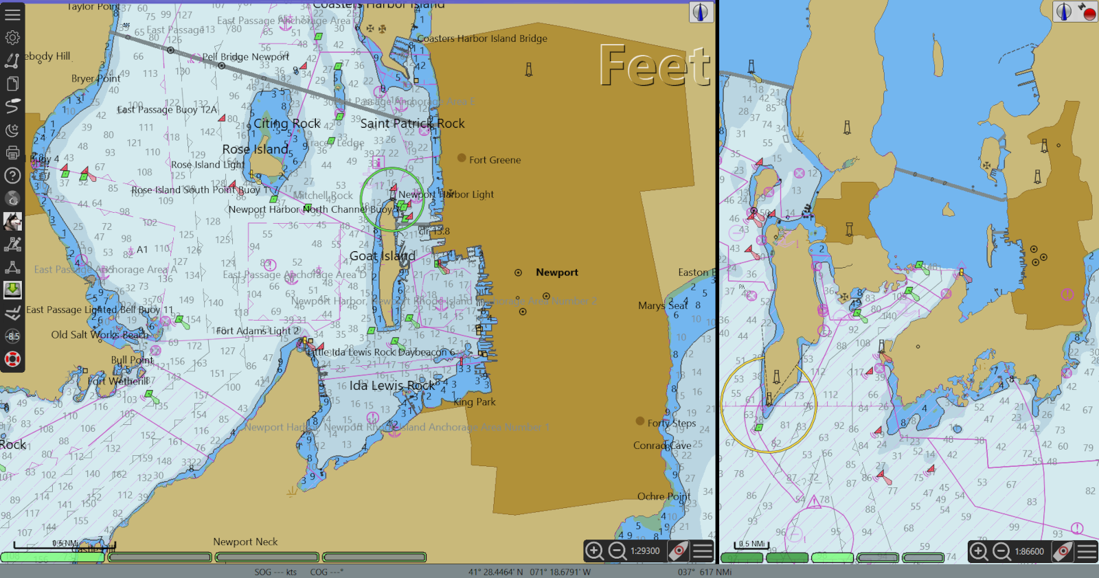
Explore our comprehensive review of OpenCPN, the premier open-source marine navigation software designed for reliable offshore and coastal plotting.
The Ultimate Open-Source Marine Navigation Solution
The OpenCPN marine navigation software has established itself as an indispensable resource for sailors, cruisers, and maritime enthusiasts who require a robust, reliable, and highly customizable chartplotter. Developed by The OpenCPN Community specifically for the Linux platform, this open-source application delivers professional-grade navigational capabilities directly to your ship-borne computer system without the premium price tag of proprietary hardware.
Who Benefits Most from OpenCPN?
Whether you are planning a weekend coastal cruise or embarking on a challenging transoceanic passage, this platform is engineered for mariners who demand precise control over their navigational data. It is particularly suited for hands-on navigators who appreciate a highly configurable interface and want to integrate diverse hardware sensors—such as GPS receivers, AIS transponders, and autopilots—into a single, cohesive command center.
Key Features of the OpenCPN Marine Navigation Software
At the core of this application is a powerful engine capable of handling complex navigational tasks. The system is designed to process real-time data inputs seamlessly, ensuring that your situational awareness on the water is always up to date. Key built-in capabilities include:
- Comprehensive Position Tracking: Full support for GPS and GPSD position input and real-time vessel display.
- Versatile Chart Compatibility: Seamless rendering of BSB Raster Charts alongside S57 Vector ENC and CM93 charts for worldwide coverage.
- Advanced AIS Integration: Built-in decoding and visual display of AIS targets to assist with collision avoidance in busy shipping lanes.
- Autopilot Integration: Direct waypoint navigation capabilities to steer your vessel along pre-planned routes automatically.
Expandable Functionality via Plugins
Beyond its core charting engine, the OpenCPN marine navigation software features a flexible architecture that supports a wide range of community-developed plugins. Users can easily integrate real-time weather overlays (GRIB files), tactical racing tools, specialized annotations, and detailed tidal data. Additionally, pilot charts and supplementary add-ons can be acquired directly from the project's official website to further enhance your voyage planning.
Get Started with OpenCPN
If you are looking for a dependable, community-backed chartplotter that puts you in complete control of your maritime data, this application is an outstanding choice for your Linux navigation setup. To explore the software, download compatible charts, or join the community of global mariners, visit the official OpenCPN page on Flathub today.